Faculty Interviews
The PBRC Director occasionally has opportunities to talk with the past and present PBRC faculty fellows as well as SUA faculty about their recent research.
Faculty Interviews
In August 2023, the PBRC Director had the opportunity to talk with Monika Calef, Associate Professor of Physical Geography and the current director of Environmental Studies, about her recent research funded in part by the PBRC, in particular, her recent publication in Forests: "Predicting the Unpredictable: Predicting Landcover in Boreal Alaska and the Yukon including Succession and Wildfire Potential.” (This interview has been edited and condensed for clarity.)
J P Kehlen
Could you tell me about the origins of this project and how it came about. For many faculty, there’s usually moment spent reading or thinking and all of a sudden we think, what would happen if I asked this question? So was there such a moment for your work?
Monika Calef
This paper started with an email from somebody asking me if I can give her my vegetation layer map that I created many years ago when I was a postdoc. I used logistic regression to create a vegetation map of the Western Arctic — that's Alaska and Western Canada. But it was at a one kilometer resolution, one vegetation type for each kilometer. So it was very simplified, and she wanted a much more detailed one. The one I had created wasn't very accurate, and the resolution wouldn't work for her; she wanted it at 30 meters. And you can't just go from one kilometer to 30 meters. I mean, you're going to end up with garbage.
JPK
That's three orders of magnitude of difference, right?
MC
Exactly. So then we decided to basically work on it together. She just asked me, hey, can you send me that layer and then four years later, I actually had a final product. It’s been very, very slow going. It was immensely complicated.
JPK
This is one of those amazing aspects about academic life that sometimes isn’t always apparent, that a chance email or encounter between two people in different fields can throw off a mental spark, and from that, an entire new kind of analysis can emerge.
MC
That's true. It’s funny because her big project that looking at land cover change in three locations in the western Arctic. And she worked with economists and sociologists to go to villages there in order to tell them about future scenarios and how they can address the future areas that are going to be prone to wildfire or other damage. It’s really all about working with communities to help them address better preparedness for the future, to assess risk and vulnerability, and then to come up with better scenarios. The vegetation map was just one little basis that then fed into all the other questions. And so this one small thing that was just going to be sort of a spark turned into this huge project that four of us worked on for four years.
JPK
So something that seemed not trivial but relatively unimportant in one study then became the central aspect of a new study altogether.
MC
Yes, kind of a spin off. And I was happy to work with them because it was a great opportunity for me to work with a big research group. Then I quickly realized that I'm wading in over my head. And so I asked Anna Varvak to help because I've worked with her on to other papers, doing statistical analysis because it all comes down to statistics, and it's all spatial. So it violates basically all the normal assumptions of statistics, and you need very advanced statistical models, and then trying to find all the data sets. It was really a lot of my collaborator Jen's ideas and Anna’s analysis and I'm kind of the go-between.
JPK
And here the go-between is terribly important for translating data and information from one field to another in a way that is useful for them both.
MC
Yes, and because I had worked with Anna previously, I knew how to talk to her with a math background and from us with the science background, I could give her data and she could analyze it, but some of her analyses didn’t make any sense from an environmental perspective because she didn’t understand what she's looking at.
JPK
You make it sound like serving as an interpreter between different languages. That sounds like the definition of interdisciplinary.
MC
It's completely interdisciplinary. And that's why it's difficult to explain exactly what we did, because there are so many different arguments that create the entire project.
JPK
Could you give me a simple explanation of land cover and why it is so important to this study? It's clearly a term that’s fundamental to your research.
MC
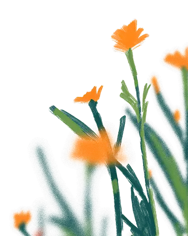
Land cover is basically when you look at the landscape, what does it look like? Is it trees, is it tundra, is it water? What is the surface like — what’s the vegetation, essentially — or does it not have vegetation? And that has important implications in terms of climate, fire, permafrost. And those are the things we were looking at. So the permafrost is usually under black spruce trees, because they are the only trees that can grow on permafrost. That means the ground has been frozen since the last ice age, right? So it's been frozen for thousands of years and still that's the only tree they can grow on it; when you wander around the landscape and you see black spruce, then you know it's going to be frozen underneath it. It gives you some idea of what the soil is, what the moisture is, is there acidic water or not under it, what kind of rock is underneath it. So just by looking at the vegetation you have a very good idea of sort of the larger environmental picture of that place.
JPK
It's amazing to hear you say this, because I just heard you define land cover in narrative terms — that every different type of land cover tells us a story about not just its location or what grows there, but about the entire history of that specific spot.
MC
Yes, that's essentially what happens and that's why we want to know, how does the land cover change over time. And that was really the going question for this project: from 1980 to 2060, what does the vegetation and land cover look like in Fairbanks, Anchorage, and in Whitehorse? Because that gives us an idea of how will the vegetation and the permafrost change, and how does the risk of fire change, because fire only burns mostly in black spruce. So if you have a house among black spruce, it's going to burn. [The analysis] tells us about vulnerability to fire from these soil changes. And that's what we were interested in because that's the information communities need, so they can figure out how to plan for the future. If you're going put people there, then they need to be able to escape and you can't just have one road, you need to have multiple routes of egress — this kind of scenario planning is critical for the communities; they need to have kind of a future landscape where they can see what the future might look like. That was the driving factor behind this project.
JPK
Paraphrasing what you said, looking at land cover through time can reconstruct data beyond the present as a way to predict what is going to happen, which is incredibly useful from many different perspectives for the communities and government in those locations.
MC
But it's so hard to do, which is why the title is “Predicting the Unpredictable,” because we can’t know the future. Climate change is messing up everything; we know it’s getting warmer, we know it's getting drier in those areas. That means things are going to burn more but none of this change is linear; none of it is perfectly predictable. Your d is some ridiculous number because you have wet years, you have dry years, you have super-warm years, then you have cooler years like this one: it rained all summer and nothing burned. So a major problem is, how do you predict the future if there's so much noise in the in the data.
JPK
Which connects to the varying degrees of reliability discussed in your paper.
MC
Yes, exactly. There are large climate cycles; in theory, every 30 years it gets drier and then it gets cooler again and that influences vegetation and fire. But there are other cycles that we don't even of know yet. So this is where climate science is just starting to discover these connections, because in order to figure out 30-year cycles, you need 100 years of data. Our satellites have only been around since the 1980s, so we don't have that long of a record. That's why these patterns are just now slowly starting to emerge with supercomputers and high resolution satellite data, and we're starting to see these things because they were not immediately obvious. That's why we started in 1980 to see how has the vegetation changed in that time, what does the climate look like, what does the fire situation look like. And what we found is that you already see extreme fire years, such as 2004, when my son was born, everything burned, and we were trying to leave just to get away from the bad air. You have years like that every couple of decades. But then in-between, it's not so bad — like this year, it rained all summer. That’s why we decided to do decadal analysis — we throw 10 years together and take some kind of average because there is much variability. Then that gives us a kind of estimate: “Okay, we have the sort of decades where you don't have a lot of fire and then you have a decade where you have these huge fire years, maybe just one, but it raises sort of that area burned tremendously by a factor of one or two.” That’s why we decided we're going to use it for predicting the future. And then there's the whole feedback from the vegetation. Once you burn all the black spruce in the landscape, you don't have any fuel left, so it’s not going to burn and that's what all the other models are showing — that the vegetation is changing. The black spruce is vanishing from the landscape. Of course it can grow back but it needs 60-70 years. But if the fire comes back too soon, then you don't have spruce trees coming back. So you're changing the landscape, and that's the hope for the future, that once you burned all the black spruce, the fires will stop. But now it's a bad time for these communities because the fires will just keep going up. And of course, that keeps feeding back into the carbon cycle; you will have more carbon released from these forests and the permafrost, which is a huge carbon sink and methane from the bogs, which is even more powerful. So then you have feedback that is just going to make it hotter and drier and you'll get more fires and then you have even more feedback.
JPK
Please say more about how you use statistics in this project.
MC
Well, we have different study sites, and some of the data layers cover the whole study site, and some of them don't, because it's so difficult to find data for Alaska. That's why we're trying this study, because there was a very intense Western Arctic exploration from 1984 to 2014, which was our basis. We also found other types of data, each with its own issues of interpretation. For instance, I had data for three different vegetation layers in and around Anchorage. They were created at different resolutions and I was trying to use them to verify each other, but they are completely different — they have different definitions for land cover types; one of them says this is a spruce forest, the other one says this is a shrub layer, and so they're all really, really bad. And that's a problem because you have satellites flying over the landscape taking pictures, but they’re not going to be that accurate, right? I mean, the algorithms are getting better, but the precision's still not there. So a lot of the statistics I use correlates datasets to see: do they correspond with each other? For example, data for tree height or different soil parameters, such as how much moisture is in the soil or the pH of the soil water. Sometimes you find that some of these data are showing you kind of the same thing. So you can drop some parameters out; you don't need to have 20 parameters if 10 of them are kind of the same thing. Then you look at correlation: if just one goes up do the other ones go up too, and then can I just not use them? So this is back to my knowledge of the landscape. Understanding what these things mean and the statistics of okay, if they have an R-squared of close to one. Obviously, it's not going to add any new information if I add this one.
JPK
So you’re taking two different modes of analysis — environmental science and statistics— and find the place where they meet —
MC
Right. And, understanding that the metrics are nearly the same thing environmentally speaking, the statistics show me that I don’t need all the parameters.
JPK
Then you’re using these statistics as a way to translate numbers into a functional understanding of environment.
MC
Yes, exactly. That's a good way of saying it.
JPK
I remember that Anna once told me that people are afraid of statistics because they think, it’s just math, math, and more math, but when we think about the purpose of statistics, which is to create a better understanding of the real world, most people find statistics then becomes incredibly interesting.
MC
My life is all about patterns. As a geographer, I'm trained to detect spatial patterns so I can make a map and look at it. I don't necessarily see the patterns on that map. But if I run statistics on the data, I can then see the patterns because its statistics will show me if there's a pattern or not. And then I have to go back to the map and think, yeah, I can kind of sort of see that, or overlay different parameters and then it's starting to crystallize for me.
JPK
It's interesting to hear you talk about patterns, because, as a philologist, I’m also always looking for patterns in language through history and culture as a means of getting a clearer insight into “what did this person mean by using these words?” And in almost every field of scholarship — natural science, social sciences, humanities — we’re all looking for patterns and trying to figure out how to interpret them, even if the ways we describe those patterns or analyze them are often startlingly different.
MC
That's true, and for me, it's even more important to ask, which statistic could I use to tease out that pattern, or how could I overlay these data or change them? So Anna did a lot of this work. She basically converted data logarithmically, like the natural log, because otherwise there’s too much noise in the data; the fire could be one acre, or it could be a million acres. If you put that in linear regression, it's just going to be blowing up. By transforming the data, you normalize it by dividing it by the highest number, so that you rescale everything to 100. Then it becomes a little better to start overlaying the data and analyzing them. So it's little data tricks like that that I've now learned from doing this study.
JPK
That sounds like you became a data detective.
MC
Yeah. But that's where I get excited. And I love data! So that was the prep work figuring out which datasets to use, where to find them, which ones work for us. And then it was a question of, okay, I want to predict the vegetation. I have these data sets. How do I put that together so it gives me a future vegetation layer? And that's where Anna came up with a computer machine learning model, which was able to take the data we had and to interpolate it. So you train the computer and you do different testing to make sure you will have the best statistical models, different ones for each of our time periods and locations. And then, we run our statistics into our fancy model to see what it does — something would have been impossible to do without automation. It is an ensemble learning algorithm that combines prediction for multiple decision trees; it builds a decision tree based on the data, and then it builds another one and refines the previous one — every time it runs through, it improves on itself. You run this over and over and over —
JPK
Which is totally different from just using randomization —
MC
Exactly. That's something we couldn't even do 10 years ago, because we didn't have the capacity for all these statistics. Now that the models keep getting fancier and the computers keep getting faster, we can do this.
JPK
Machine learning isn't something to be afraid of, in other words,
MC
No, not at all. We couldn't do this study without it, because it's so complex.
JPK
One last question. At the end of your paper, you write, “Our relatively simple modeling approach could serve as a blueprint for similar efforts elsewhere.” What are the possible implications of that sentence? Because it suggests that not only your findings but the methods themselves may provide future paths for other researchers in a variety of fields.
MC
We did use a very simple model. Other models that predict the future are super-complex ones that people, some of whom I’ve worked with, have been working on for years and years. My postdoc was with someone who has a model that runs on multiple platforms and he’s had full-time programmers creating these models that calculate all the detail of the landscape; you’ve got climate, you've got the vegetation and all the soil interactions, which is critical because you need to know how the water cycles. You need to know the soil types. You need to know topography. That's dictates how vegetation and fire interact with each other, so those models are hyper-complex. But our model is really a simple statistical model, and it’s free. You can literally download it with our data; everything we used is available online. It's all free government data. So compared to the existing models now in use that are so extremely complex and, of course, owned by somebody who has spent 10 years building them, ours is relatively simple and open-source.
JPK
A way to look at complex data without oversimplifying and still make that useful for a variety of different fields or types of research.
MC
Yes, and there are multiple uses because everything's changing. I mean, climate is changing everywhere. I’m thinking that someone who doesn't have a fancy, expensive computer models at their disposal could download our script, and they can modify it, get some kind of data that they can find for their area, and then use this approach in general.
JPK
An outcome that’s beneficial for your own field and for other researchers.
MC
We spent four years figuring it out, but now that we figured out how to make it work, you can modify it to whatever will work for your study, so it’s incredibly flexible, and you don't need that proprietary model that's going to then run in some kind of computer ensemble for a month or more.
JPK
Congratulations on your project, and thanks for giving us more background about your research — and for sharing your enthusiasm about data.
MC
I love talking about statistics! And thanks to the PBRC for the grant that helped that fund our research.
J P Kehlen
I’m here with Anne Pearce, SUA’s Professor of Studio Arts, who was a 2023 PBRC faculty fellow. Today, we’re here to talk about her research experience in Japan. I hope you don't mind if I dive right in.
Anne Pearce
No, dive right in, and I've been thinking a great deal about research versus search, and I think I may have participated in search as well as research.
JPK
Two directions that ended up in the same project.
AP
I would say so, yes.
JPK
I can't wait to hear about it. But could you give some of your background for our readers who may not have met you, as you’re a relatively new faculty member. How did you end up coming to SUA?
AP
Well, I was in an ice-cold basement in Kansas City, Kansas. And so I thought, self, you've always dreamed of finding your way out of the frozen Midwest: have a look at the College Art Association! And at that moment, in this dark and cold and dreary studio, I found the advertisement for Soka University of America. After I read something describing the creative coexistence between man and nature, between humankind and nature, I thought to myself, rather egotistically, this is my kind of place. So I then went on to read about Soka University, the SGI, and Daisaku Ikeda. I did a thorough amount of research about the mission and values of this university, its goals and objectives, and the absolute diversity of its student body. And more than life itself, I wanted to have this position. To my surprise and great fortune, I was awarded this teaching position, and I have been very, very happy since then.
JPK
I can attest that we're all very happy that you are here! I noticed when you talk about your journey, it is from the middle — the Midwest and its cold — to the edge of the continent, almost right by the Pacific and someplace much warmer. Has this change in not just the natural environment but the educational environment changed your work?
AP
I think that it has. And in discussing one's work, I think that our contemporary culture sort of demands categorizing, which I find an inherent challenge. So my work, quote unquote, has three or four prongs. The first is deep immersion and observation of nature. The second is teaching, understanding, and observing these students and knowing who they are as individuals and also as a group, as an organism. The third is my own artistic practice. And the fourth is moving through this university situated in California. And when I try to describe what it is like to be working in Southern California, people may imagine flawless Amazons in bikinis strolling along the beach. But really, what I have here is the entirety of the world — each student or colleague represents to me an entire world. Each human is a book in this cultural library where I, in my great fortune, get to read them, to learn from them, to have my horizons expanded because they have traveled from multiple parts of the world and appear here with so much to give, and I only hope I can give in kind to each of those students.
JPK
What you just described is almost an exact expression of what Buddhist thought identifies as the unification of self and environment — that the very small and very large interpenetrate each other seamlessly as an objective for living a meaningful life, that the self and the space the self occupies become one.
AP
That is my goal: to be a part of, to not sit on top of or lord over, but a part of the greater whole. The greater whole.
JPK
What was the impetus or inspiration for your research in Japan?
AP
The impetus for me going to Japan was to better understand culturally and artistically the respect, the use, and the necessity of unfilled spaces— to observe space in nature, in the way gardens are designed, to observe it in artworks, to observe it in the restraint of speaking, to not have to fill the whole space but to listen to open space as an act of generosity and politeness. That was the impetus for my research there.
JPK
I remember our discussion some years ago about the Japanese idea of ma — empty space that is not a void but that itself has meaning and connotes value.
AP
That’s right! So my first monumental moment in Japan: I arrived in Nara, actually in a small village just outside Nara, at a residency called the Space Department, founded by an architect named Eugene Solar. I arrived and was by myself for three or four days, and my inspiration was a very small island, a space dedicated as a tomb for an ancient Japanese emperor. You can walk around the little moat that surrounds it. To me, that represented space apart from humans — it was untouched, no one was allowed over there. So what happens with that open, natural space? It flourishes with life. Insects, turtles, birds, butterflies. It's extraordinary. So that’s been the inspiration for composing several haiku-like works, which will just be moon, island, stars, and the natural world. In my paintings, I respond to this speck of space on Earth that has been untouched by humans as a glowing example of what we might do if we allowed more space for nature to thrive.
JPK
And to be specific, a space made sacred by absence...
AP
That's correct: the absence of the emperor's life, the absence of people, the absence of so-called civilization creates that sacred space.
JPK
As a first-time visitor to Japan and as a visual artist, what are some of the things that struck you the most during your stay?
AP
I would say a memorable one was when I went to a large museum in Nara. It was a massive exhibition, filled with people, wall-to-wall people. And it was quiet! People spoke in the softest whisper — it was like being in a large vessel with only moths’ wings patting each other. So I was allowed to be in a massively crowded space without the disruption of human egos yelling over each other; it was a collective awareness of others, unlike anything I've ever come across anywhere. I was also struck by the amount of spiritual objects created on this small island, such as at the shrines and temples, the kind of magical viscera like this that takes lots of humans quietly working in service of one thing that is not their own. They are creating in service of the whole to make something of magnificent scale and depth and to awe hundreds and hundreds of individuals, for everyone to experience together.
Any sense of aloneness I felt because of the language barrier was at once removed by these acts of architecture, these sculptures that were done in service to all — they made me feel included instead of excluded.
JPK
That's a compelling observation. I’ve never thought about it, but in Nara there are so many of these enormous sacramental buildings, some of them more than a thousand years old, and they are huge in their scale, but they never feel inhuman.
AP
That's right. Because my host is an architect, he gave us extensive tours and showed us that if you stand at a certain point beside this tree and this rock, all of the choices made by the architects were in deference to nature. You don't cut nature down, you work with it. This idea is at the root of everything that interests me as an artist: how does this creative coexistence, this imaginative empathy for nature, function? And I saw this idea made visible again and again. Once we were walking from the residency to see one of these shrines, and we met a Japanese woman in front of her home, where she had this bush dotted with perfect pink flowers. She saw me staring at her flowers in a kind of unrestrained American ecstasy, and she invited us into her home. She shared with us the sculptures made by her husband and the memorial shirt for her father and grandfather. Then she came with us to give us a tour of the local nature. And (thanks to Google Translate) she told me about the plants around us, for example, this particular plant's leaf is the one you use to wipe away tears. It was a special, intimate moment where we were just humans together. Everything was just brought together into a humanness and a shared moment of experience.
JPK
And in these kinds of experiences, you were noticing the relationships between human beings and nature in Japan and also between human beings and human beings, which are fundamentally different on the side of the Pacific.
AP
That's right. I have never experienced anything like it in all my travels. I have not had this kind of experience before.
JPK
The next question is a big one. Natural patterns and processes are terribly important to you; they’re the fundamental link between everything I've seen in your work. The Japanese idea of nature and how Japanese art sees nature is fundamentally dissimilar from Western ways of seeing nature. For you, as a creator and especially as an artist inspired by nature, has this different conception of nature changed your understanding of the natural world?
AP
An artist's residency is a physical space where you go that is dedicated to making work and having experiences.
JPK
A space dedicated to creative power.
AP
Correct. My residency host invited two traditional Japanese artists. In my conversations with them, I began to understand that it takes hundreds and hundreds of hours of deep observation to extract an idealized essence of nature. How do you arrive in a space where you can, with one flick of your wrist, capture the essence of a blade of grass in ink? Japanese brush painting is not layers of paint, where we're covering one layer up and we're reworking another layer. Their art is a kind of communion that requires much time, observation, and practice to arrive at a singular moment of a mark that a huge group of people can feel. An instant recognition of: I know what the sun feels like on my back, I know when I'm bent over digging the rows in the garden, I know when I look over at that blade of grass and I see a cricket bending it ever so slightly. I know what that is because I've gardened my whole life. And the artist knows how to capture that essence so that the moment experienced in the painting and the life lived in nature are synonymous. If you are ninety years old and you cannot garden anymore, but you have a painting, you can look at that blade of grass and that cricket, you are allowed to travel through time and space and your experiences, and to return to that feeling, even though you physically may not be able to.
JPK
In other words, the artist must prepare to capture a moment that transcends their time and ours.
AP
That's right. They have to spend hours and hours and hours, untold, unseen, immeasurable hours learning to prepare. So when you ask an artist, How long did it take you to make this painting? If we are measuring with Western measuring sticks, you could say 15 minutes, maybe 15 seconds. But if we are looking at another metric, one that has to do with an unseen life of dedication to observing and participating in the natural world, you would have to say hundreds and hundreds of hours to make this painting.
JPK
That's consonant with my own experiences with Japanese literature and the performing arts. Because when I was studying traditional drama, if you're walking across the stage, you're not just walking. The performer must have an immense focus. Every single motion within the act of walking itself fits into an aesthetic pattern. And the patterns look very simple, but they’re incredibly difficult to perform. When I observed my teacher walking on stage, it was as if he was floating over the surface. I once asked him how long it took him to learn how to do that, and he said, Oh, maybe 40 years of observing people walking.
AP
That's right. And I think we see that attitude in all of the Japanese arts and craftsmanship as a whole, an attitude that’s still there as a way of understanding human creation and its purpose. The other fascinating aspect is that minimalism reveals vulnerability.
JPK
That's a fascinating phrase. Can you elaborate on that?
AP
By using so much economy, you reveal your choices. You reveal your drive for getting the image, the moment just right. And there is no distraction from that moment. None. It’s there in ikebana [traditional flower arranging]. The ikebana in this particular arrangement in this tea house in this light on this day in winter all conspire for a moment of transcendence.
JPK
What you’re saying does point out this amazing paradox about the Japanese arts, like ikebana or ink painting or poetry or even all craftsmanship in general: to make things transcendent in a way that seems instantaneous and perfectly natural, one must learn to practice every single possible artificial skill of representation.
AP
That's right. That natural spontaneity is actually 100% controlled, and it's not natural. It's just to the side of natural. Because nature doesn’t attain the perfect balance required between symmetry and asymmetry. And the tension between those two, it just doesn't happen in the natural world. There's always some extra stick coming off a perfect branch. You're like, What’s this? I'm going to snap this off. But they do try to shape the gardens. But it's not as woolly as nature. They extract the woolliness.
JPK
Let’s say, nature gets sanded off just a little bit.
AP
That's right. It's never such a big adjustment to nature that it seems artificial. It's just enough to make things seem more natural.
JPK
More natural than nature.
AP
It's a wonderful paradox, isn't it?
JPK
It is. So, for you as an artist, that must have been an extraordinary revelation.
AP
Another revelation: I returned to California and took a walk in my neighborhood, in a park not far from here, and it was an inversion: there was just the lake, and the whole perimeter was covered in birds. But there were humans in that space as well, you know. So the revelation is that you can have new eyes every day if you pause long enough to use them. And going to travel to another place is the greatest luxury because you're bestowed perpetual newness for some time. Thanks to the university for this opportunity. It's been invaluable, it reawakens my eyes, and I am able to use them even upon return. But in Japan, everything felt like art to me. Even the food was itself an artistic experience.
JPK
Do you have plans for further visits to Japan to continue your research?
AP
Yes, I've been invited to return. The residency directors are very interested in collaborating for a learning cluster, so our students can learn to make paper, ink, and brushes in the traditional way. To preserve traditional arts right now is extraordinarily difficult.
JPK
It appears that there are far fewer young Japanese people willing to apprentice these days. There are traditions, not just the fine and the performing arts, but even culinary or folk crafts, which require serious dedication in the amount of time, human attention, and focus required, often for very little to no pay. This unfortunately has less and less appeal to the younger generation. Over the past 30 years, when I've been speaking to traditional artists, I hear over and again, “I want to pass on my craft on to someone, but fewer young people are willing to go through this type of rigorous training.” Because it's a lifetime of practice and creation. It’s not a hobby or a pastime.
AP
No, it's not an emoji. It's a longing. It is a lifetime.
JPK
It is. And that, to my mind, also makes everything from culture, arts, and language in Japan interesting for a lifetime.
AP
I agree.
JPK
Could you tell us about what plans you have now for your work since you've come back, as you were mentioning?
AP
Yes, I have been invited to return to this residency, which I will do, and I plan to create a body of work based on these experiences that I will really be able to dive into once my sabbatical begins in the spring of 2026. I have been invited to participate in a group show in Kyoto in two years’ time. I would sincerely like to have an exchange or partnership with galleries and museums, or to host an exhibition of traditional and contemporary Japanese artists. These are all things that I'm thinking about.
JPK
I should add that the extraordinary depth, not just of traditional artists but of contemporary artists in Japan has always amazed me.
AP
Totally. They may work in media and in a way that is utterly different from traditional art, but they still place extraordinary attention to every single detail of their craft.
JPK
Taking traditional values and creating something completely new out of them.
AP
Exactly. And as you know, I'm new to my work in the SUA gallery, but I'm interested in how our students can forge opportunities for them to gain experience within the framework of our gallery and studios on campus.
JPK
How does your recent research and travel connect to the work that you do with students both now and in the future?
AP
Coming to this school, I wanted to pay very careful attention to a recognition of empathy, meeting and understanding students from all of these different parts of the world, and such different cultures. But I think experiencing Japan has lent so much more to that ideal. I have so much more awareness that these materials, processes, and artworks that I have experienced are really important. They're important for being human. It's important in that you understand all the differences, such as what does it means to be efficient? versus what does it mean to make a commitment of time and energy to the creation of something lasting? And so how do we look at something that's a disposable throwaway versus something that endures? And just like the way sumi ink is made, all of these things don't just appear out of nowhere. These creations represent lifetimes of experimentation, refinement, and learning. The ink on the page captures the language, captures the history. If you think about who you are and how you've landed on this planet, you get to think about all your ancestors, all their experiences, what they have felt, and what they know. And ink and paper allow you access to this. They allow you to create something refined, something that can’t be captured in the framework of our mediated world. There is a different feeling if you see a painting in person versus on a laptop. What does that image mean to you? What does that image do to you? What does it do to you biologically, emotionally? These are all change agents in your being. Your experience with any of these things could afford you more empathy. It could afford you to imagine a human that lived one hundred years ago, just as it can afford you the ability to empathize with someone alive now.
JPK
Which is to say, a work of art is itself a statement of faith that someone else can commune with. A work of creation that is saying, “I am here. This is how I see the world.”
AP
That's right. You are not alone.
JPK
And you are not alone. I have one more question. In many different contexts, students often let me know that they understand that creativity is important. They understand that being able to think not just “outside of the box,” but outside of the cliché of the box itself. They ask me how they can think of the world in ways that will allow freedom for their ideas and clarity for the perception of others. So when students ask, “What can I do to more deeply engage my creativity or let free my creative power,” what advice would you give them?
AP
My advice would be to recognize that creativity is not for some. It is for everyone. First, know every single human being enters the world with a unique constellation of gifts. And as a young person, they are inundated with the things we’re supposed to want and have, prepared by the world of marketing. In response to that, they ought to find time to know themselves and know who they are. Then they can look at art, read books, experience the acts of creativity that they have access to, and trust themselves to find the wherewithal and courage to make mistakes and to find what’s right within that. The act and process of doing will reveal things that you could not have imagined. And to go forward, a major part of creativity is the act of recognition. The act of change in the midst of being on a path that you think you are supposed to be on. Why? You must question why all the time. You must be aware as you are moving through time and space on your path and wonder, “Is this still right? Is this what I want?” Creativity is pivoting in a moment. It is staying on course in a moment. To be creative means, let me see what happens next. I'm going to see what happens.
JPK
To be persistent yet at the same time open to change and transformation.
AP
Exactly. So what's the worst thing that can happen if you veer off your path? You get off a paved road, you wander into the woods, and you turn over a log and discover a creature with a hundred legs. What? Would you have found legs on the road? No, they're running away from the pavement. And that moment of discovery is when we turn the page. We start a new sentence. We begin a new book. We start a new painting.
JPK
That sounds like you've just described the ideal life of a liberal artist.
AP
I hope so. Especially at a liberal arts institution!
JPK
It's hard to end on a more apposite note than that. Thank you again for telling us about your experiences in Japan, and we’re looking forward to your presentation this fall for the PBRC.
AP
I'm looking forward to it as well. Thank you so much for this opportunity.
This interview was held in Professor Pearce’s campus studio in July 2025. It has been condensed and edited for clarity.